


.le Pic de Bure

dansanet
User
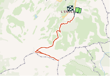

Length
17.9 km

Max alt
2696 m

Uphill gradient
1376 m
Km-Effort
36 km

Min alt
1427 m

Downhill gradient
1398 m
Boucle
Yes
Creation date :
2025-07-04 06:28:42.212
Updated on :
2025-07-05 13:41:22.239
8h23
Difficulty : Difficult

FREE GPS app for hiking
 SityTrail
IGN / Geographical institutes
SityTrail Plus
The world is yours!
About
Trail Walking of 17.9 km to be discovered at Provence-Alpes-Côte d'Azur, Hautes-Alpes, Le Dévoluy. This trail is proposed by dansanet.
Description
c8.
Positioning
Country:
France
Region :
Provence-Alpes-Côte d'Azur
Department/Province :
Hautes-Alpes
Municipality :
Le Dévoluy
Location:
Saint-Étienne-en-Dévoluy
Start:(Dec)
Start:(UTM)
734011 ; 4949575 (31T) N.
Comments